 Travel tip #5 If you're ever in Belize and you see a road on the map that's called "Old... So and So" and it looks like a shortcut. Just ignore it. Maybe the first 15 feet are paved and the rest is mud and giant car eating craters, no gas stations or restauraunts. Trust me on this. Stay on the highway.
Here in Belize we have 3 paved highways. That's right folks, 3 highways. Not your super expressways, but just 2 lanes all the way, and we're GRATEFUL for them. All of the highways are appropriately named and easy to remember. The Northern Highway connects Belize City to the northern border of Belize and to the border with Mexico. The Southern Highway includes the Hummingbird Highway (the prettiest stretch of road in Belize that takes you through lush valleys and little mountains) and connects Belize City/Belmopan to the southern towns of Dangriga, Hopkins, Placencia, Mango Creek and Punta Gorda. The Western Highway connects Belize City to the western border with Guatemala.
 Last week, while I was on the mainland at my studio backabush, between torrential downpours, which produced flash floods, Roaring Creek roared and went over its banks for the second time in 2 months, cutting off Eastern Belize from Western Belize. We are near Mile 31, and Mile 8 and Mile 42-44 were under water. We're not talking about a little bit of water either, it was the overturning busses kind of flood, effectively trapping us between floods. Thank goodness we had stocked up on food... or I might have been forced to skin and eat Bigness, although he's way too big for the freezer.
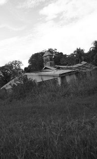
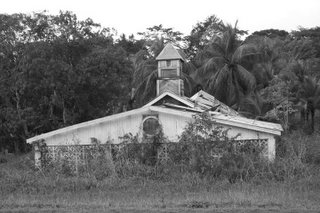
The day after they opened the highway we ventured out to take a look around and I shot some photos I've called Disorganized Religion. I was able to shoot them because Bigness was driving slow enough that I could actually stop him before he whizzed by (again) this old abandoned church in Teakettle Village between Belmopan and San Ignacio. He likes to pretend he can't hear me say, slow down I see something I might want to shoot.


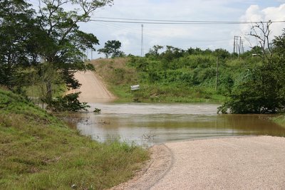
Feeling so confident and impervious to harm, we decided to go on down a side road to Spanish Lookout, a Mennonite community of farmers and builders and get building brochures for a friend who is thinking about building a house here on Caye Caulker, I'm just about to break out in song (Over the river and through the woods, to Grandmother's house we go, the horse knows the way to carry the sleigh thru white and drifting snow...) OH SHIT! SCREECH! HALT! Back that baby up. You can't even see the bridge for the water covering it.

I get over my heart attack and stroke, and make him let me take a picture, then he turns the truck around and we head back to the main highway. I see another truck barreling down the road towards us. I ask Bigness if we should tell them about the bridge being out. No, he says (and gives a little smile), they will see it soon enough. I say, O.K. den, you are de boss. I turn around and watch them as they whizz by us. Sure enough, brake lights. Screech... halt!


7 comments:
waaaaw- what gives-- isn't it supposed to be DRY season!?!?
yeah, i learned my freakin' lesson about driving in central america-- what usually happens? how do they bring the food over if the flood is more damaging?
You have to wait it out. If its real bad then the British military will come to the rescue, but it has to be real real bad before that happens.
Lee: You bring up a good point; Weather can be a killer. In the SW United States I carried two life vests, compass, a whistle, flashlights, and change of clothing at all times. The images are cool. I've always enjoyed photographing old structures because they stimulate the imagination of what once was and what can be.
OHNO!! I think I know who your "friend" is who is "thinking" of building in CC. Holy cow, I really appreciate the effort! Just goes to show ya, no good deed goes unpunished!! I'm just glad that no real damage was done. I should have been more explicit...this "friend" really only wants cement for her house and so no Menite building is really necessary.
Hey Lee,
Long time no chat. It is good to see you are doing well even in all that water.
My mother now has this policy, stock up, stock up, make sure we always have food.
I ENJOYED this post, the travelling and pictures and humour and everything.
The irony is the sign on the other side of the flood is for the Hoy Eye Clinic.
Post a Comment